Chandratal Baralacha La Trek
Duration: 6 days / 5 nights
Best season: June to September
Region: Lahaul Valley
The Trek takes us over the majestic Himalayas. After we reach the cold and dry mountain dessert of Spiti and Lahaul Valley we pass the Bara Shigri Glacier, the biggest glacier in Himachal Pradesh. Our way leads us further to the beautiful Chandratal Lake at an altitude of 4270 meters. Chandratal, which means the Lake of Moon, is shaped like a half moon and is set on a large meadow of edelweiss within a lower ridge and the main Kunzum range. From here you have a great view of high mountains and the Baralacha glacier, which is the source of the Chandra River. The trek ends on top of the Baralacha Pass (4830 m), which marks our highest point of the trek. From there we will go back by jeep and can have a stopover in Keylong (optional). This trek is perfect during monsoon time, since there is no rain in that Valley.
Day 1 Drive to Batal (3960m) 100 km
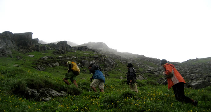
We travel by Jeep from Manali over the Rothang Pass (3978 m) and reach Batal, a small place in the remote Lahaul Valley with only two Dabha Wallas. Get used to the high altitude of the dry and cold mountain dessert with its awesome high snow covered mountains.
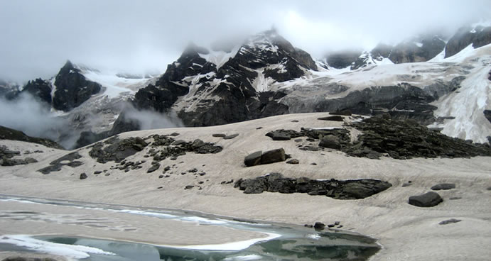
Day 2 Batal to Chandratal (4270m) 4 hours
Today we have a gradual walk with great views of many mountains above 6000 meters. We will camp at the Chandratal Lake, which is of exquisite beauty.
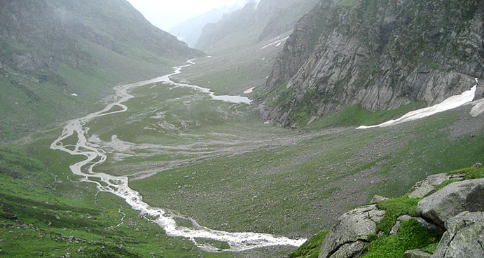
Day 3 Chandratal to Tokpo Gangmo (4320 m) 5 hours
After a moderate trek with good views of mountain peaks and glaciers, we end on the river Topka Gangmo. In Tibetan Topka means river and Gongma means big.
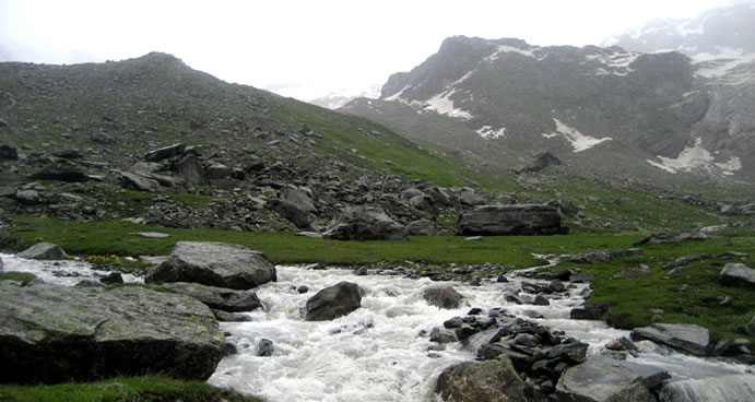
Day 4 Topka Gangmo to Topko Yangmo (4640 m) 5 hours
The trek today involves an early morning river crossing, since the water level is low in the morning. We reach the next river in the afternoon. Nice View of the C.B. Range, Mulkilla Range and of the Dhaka Glacier.
Day 5 Topko Yangmo to Baralacha La (4830 m) 5 to 6 hours Trek
Baralacha is an interesting 8 km long pass and gives rise to three rivers: Chandra, Bhaga and Yuman. Baralacha means “pass with cross roads on summit”. Roads from Zanskar, Ladakh, Spiti and Lahaul meet on top of that pass. It is the highest point of the trek.
Day 6 Baralacha La to Zingzingbar (18 km) to Manali by Jeep (167 km)
We trek via Suraj Lake, source of Bhaga River, descend along Bhaga River and reach Zingzingbar (4270 m). From there we take a jeep to Manali.
(Optional) Day 7 Sightseeing around Keylong (3350 m)
Gondla (18 km), on the right bank of the river Chandra, the tall imposing structure up on a hill is also a fortification. Kardang (5 km), the largest monastery in the area, it has barrel sized prayer drums that the monks turn during their perambulations, paintings, ancient weapons, musical instruments and large life-size statues of Buddha and the Bodhisattvas. Shashur (3km), monastery, perched upon a mountain-side, nearly 600 m above the valley, opposite Khardang.
Day 8 Keylong to Manali 115 km
Journey back to Manali over Rohtang Pass (3980 m)